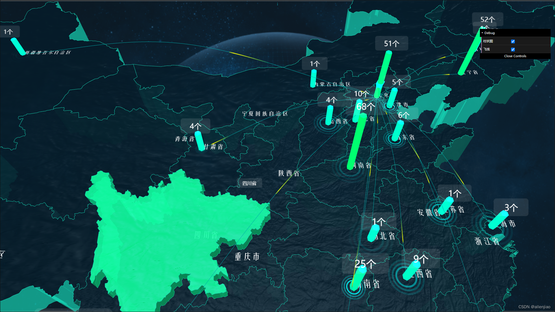
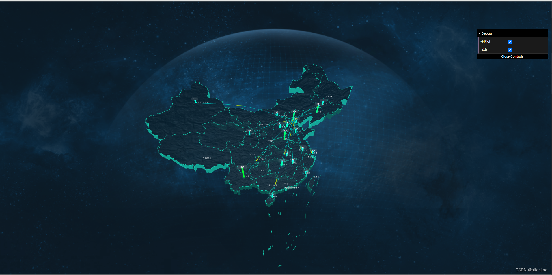
threejs地图
可视化地图——three.js实现
this.provinceInfo = document.getElementById('provinceInfo');
// 渲染器
this.renderer = new THREE.WebGLRenderer({antialias: true
});
this.renderer.setSize(window.innerWidth, window.innerHeight);
this.container.appendChild(this.renderer.domElement);this.labelRenderer = new THREE.CSS3DRenderer(); //新建CSS3DRenderer
this.labelRenderer.setSize(window.innerWidth, window.innerHeight);
this.labelRenderer.domElement.style.position = 'absolute';
this.labelRenderer.domElement.style.top = 0;
document.body.appendChild(this.labelRenderer.domElement);// 场景
this.scene = new THREE.Scene();
// 假设 scene 是一个 Scene 对象
const textureLoader = new THREE.TextureLoader();
this.scene.background = textureLoader.load("img/bg.png");// 相机 透视相机
this.camera = new THREE.PerspectiveCamera(45, window.innerWidth / window.innerHeight, 0.1, 1000);
this.camera.position.set(this.orbitParams.pos.x, this.orbitParams.pos.y, this.orbitParams.pos.z);
this.camera.lookAt(this.orbitParams.target.x, this.orbitParams.target.y, this.orbitParams.target.z);

地图数据的加载渲染
this.map = new THREE.Object3D();
this.map.add(cityPointGroup);
this.map.add(cityGroup);
this.map.add(flyGroup);let _this = this;
_this.maptext = [];
const projection = d3.geoMercator().center([104.0, 37.5]).scale(80).translate([0, 0]);
let pintArr = [];
const textureLoader = new THREE.TextureLoader();
const material = new THREE.MeshPhongMaterial({color: '#03121b',transparent: true,normalScale: new THREE.Vector2( 0.150, 0.150 ),normalMap: textureLoader.load( 'img/OIP-C.jpg' ),opacity: 0.9
});const material1 = new THREE.MeshBasicMaterial({color: '#15d0b1',transparent: true,// normalMap: textureLoader.load( 'img/earth_normal_2048.jpg' ),opacity: 0.7
});chinaJson.features.forEach(elem => {// 定一个省份3D对象const province = new THREE.Object3D();// 每个的 坐标 数组const coordinates = elem.geometry.coordinates;// 循环坐标数组coordinates.forEach(multiPolygon => {multiPolygon.forEach(polygon => {const shape = new THREE.Shape();const lineMaterial = new THREE.LineBasicMaterial({color: '#15d0b1',});const lineGeometry = new THREE.Geometry();let boundingBox = {max: { x:undefined,y:undefined },min: { x:undefined,y:undefined }};for (let i = 0; i < polygon.length; i++) {const [x, y] = projection(polygon[i]);if (i === 0) {shape.moveTo(x, -y);}shape.lineTo(x, -y);lineGeometry.vertices.push(new THREE.Vector3(x, -y, 4.01));if(undefined==boundingBox.max.x) boundingBox.max.x = x;if(undefined==boundingBox.max.y) boundingBox.max.y = -y;if(undefined==boundingBox.min.x) boundingBox.min.x = x;if(undefined==boundingBox.min.y) boundingBox.min.y = -y;if(x > boundingBox.max.x) boundingBox.max.x = x;if(-y > boundingBox.max.y) boundingBox.max.y = -y;if(x < boundingBox.min.x) boundingBox.min.x = x;if(-y < boundingBox.min.y) boundingBox.min.y = -y;}let width = Math.abs( boundingBox.max.x - boundingBox.min.x );let height = Math.abs( boundingBox.max.y - boundingBox.min.y );const extrudeSettings = {depth: 4,bevelEnabled: false,UVGenerator : {generateTopUV: function ( geometry, vertices, indexA, indexB, indexC ) {  },generateSideWallUV: function ( geometry, vertices, indexA, indexB, indexC, indexD ) {}}};const geometry = new THREE.ExtrudeGeometry(shape, extrudeSettings);const mesh = new THREE.Mesh(geometry, [material, material1]);const line = new THREE.Line(lineGeometry, lineMaterial);mesh.userData.oldMaterial = true;province.add(mesh);province.add(line)})})province.properties = elem.properties;if (elem.properties.contorid) {const [x, y] = projection(elem.properties.contorid);province.properties._centroid = [x, y];}_this.map.add(province);if (elem.properties.center) {const [x, y] = projection(elem.properties.center);const center = new THREE.Vector3(x, -y, 4.01);_this.maptext.push( {pos:center,text:elem.properties.name} );}if (elem.properties.name == "北京市") {const [x, y] = projection(elem.properties.center);const center = new THREE.Vector3(x, -y, 4.01);pintArr.push(center.clone())}
})this.scene.add(this.map);
this.loadFont(_this.maptext);
_this.ctrlBarDatas( true,'bar','北京市' );
